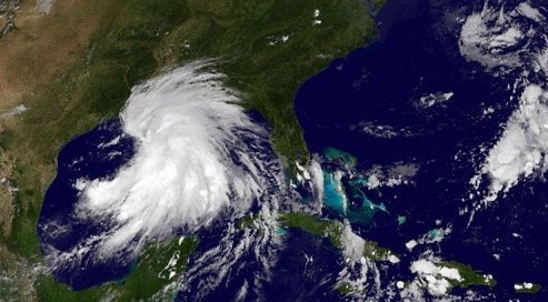
Tropical Storm Lee strengthened early Saturday morning as it inched toward Louisiana, threatening to dump heavy rains and trigger dangerous flash floods along the Gulf of Mexico coast of the United States.
Oil companies evacuated workers from offshore rigs ahead of the arrival of Lee while Louisiana Governor Bobby Jindal declared a state of emergency, urging residents to "prepare for the worst and hope for the best."
The slow-moving storm could bring the same kind of flooding that residents in the northeast are still grappling with after Hurricane Irene tore up the east coast last weekend, officials warned.
Irene affected more than 40 million people, was blamed for nearly 50 deaths, triggered historic flooding and caused what one risk assessment firm estimated to be more than $10 billion in damage before blowing itself out over Canada.
Lee was 75 miles southwest of Morgan City, Louisiana early Saturday, packing sustained winds of 50 miles (85 kilometers) an hour, up from 45 miles an hour just last night, according to the NHC.
"Some strengthening is possible before the center makes landfall" later in the day, the center warned.
With some areas forecast to receive up to 20 inches of rain over the Labor Day holiday weekend, residents in low-lying areas from Louisiana and Mississippi all the way up to Kentucky and Tennessee should prepare themselves for extensive flooding, he cautioned.
It could also bring isolated tornados.
Lee was to hit the areas six years after it was devastated by Hurricane Katrina.