
Limpert Tech for 6/30/18 on ALT 105.7 and iHeartRadio - Drones and InterDrone
Rick is at the InterDrone Show in Las Vegas this week. The topic of course, is everything drones!
Industry figures show that the global commercial drone market is projected to reach 7 trillion won ($6.2 billion) in 2025 amid growing demand in diverse sectors such as construction and agriculture as well as infrastructure management such as solar and wind power facility management, forestry disease and insect pest and forest fire monitoring, and long-distance emergency items transportation. The market is expected to expand further amid growing demand for commercial drones in the logistics sector in the United States and China.
What did he see and hear? 
Have a listen to Rick and Sully
1. Grand Opening Keynote featuring FAA Administrator, Dan Elwell
How much should the FAA be monitoring and regulating the drone industry? Safety is a major concern.
During his speech, Elwell reiterated that “the FAA is open for business.”
“Drones are going to do for aviation, what the internet did for information.”
2. Skysense Demonstrate Automated Drone Charging at Interdrone
Unique charging solution from this startup
3. Drone Insurance
AirMap, the world's leading airspace management platform for drones, and DroneInsurance.com, a digital drone insurance portal, are announcing a collaboration that will allow U.S.-based1 drone operators to purchase insurance from DroneInsurance.com within the AirMap for Drones mobile app. The app is available today and can be downloaded from the App Store and Google Play.
The integrated ability to purchase insurance is made possible through REIN's recently launched digital portal DroneInsurance.com, which aims to provide a smart and paperless drone insurance experience that offers dynamic policy options to address the unique risks, pain points and insurance needs of commercial drone operators. By providing the option to add insurance coverage as an easy, seamless part of AirMap's pre-flight planning workflow through the AirMap for Drones iOS and Android mobile app, AirMap is improving the daily flying experience for drone operators.
4. News from Parrot
eBee X: the fixed-wing drone that allows operators to map without limits
The senseFly eBee X fixed-wing drone is designed to boost the quality, efficiency and safety of geospatial professionals’ data collection. This enterprise-grade solution offers a camera to suit every job, the accuracy and coverage capabilities to meet the requirements of even the most demanding projects and is durable enough to work virtually every site.
MULTI-PURPOSE
One tool, multiple cameras, for every job
The eBee X includes a range of revolutionary new camera options to suit every mapping job—from land surveying and topographic mapping to urban planning, crop mapping, thermal mapping, environmental monitoring and many more. These cameras include:
The senseFly S.O.D.A. 3D: a unique drone photogrammetry camera with a one-inch sensor, which changes orientation during flight to capture three images (two oblique, one nadir) every time, instead of just one, for a much wider field of view. The result is stunning digital 3D reconstructions in vertically-focused environments—such as urban areas, open pit mines and coastlines—over larger areas than quadcopter drones can achieve. senseFly S.O.D.A. 3D is optimised for quick, robust image processing with Pix4Dmapper software.
The senseFly Aeria X: a compact drone photogrammetry camera with APS-C sensor. This rugged innovation offers an ideal blend of size, weight and DSLR-like image quality. Thanks in part to its built-in Smart Exposure technology, it provides outstanding image detail and clarity, in virtually all light conditions, allowing operators to map for more hours per day than ever before.
The senseFly Duet T: a dual-camera thermal mapping rig, which lets mapping professionals create geo-accurate thermal maps and digital surface models quickly and easily. The Duet T includes both a high-resolution (640 x 512 px) thermal infrared camera and a senseFly S.O.D.A. RGB camera with one-inch sensor. Both image sources can be accessed as required, while the rig’s built-in Camera Position Synchronisation feature works in sync with Pix4Dmapper photogrammetry software (optional) to simplify the map reconstruction process.
The eBee X is also compatible with the Parrot Sequoia+ multispectral camera for agriculture, the senseFly S.O.D.A. drone photogrammetry camera and senseFly Corridor for simple linear mapping.
Parrot, the leading European drone group, offers business solutions spanning drones, software, sensors and services, mainly focusing on 3 major verticals:
Agriculture
3D mapping, surveying and inspection
Public safety
Founded in 1994 by Henri Seydoux, the Parrot Group designs and engineers its products in Europe, mainly in France and Switzerland. Headquartered in Paris, Parrot has been listed since 2006 on Euronext Paris (FR0004038263 - PARRO). For more information: www.parrot.com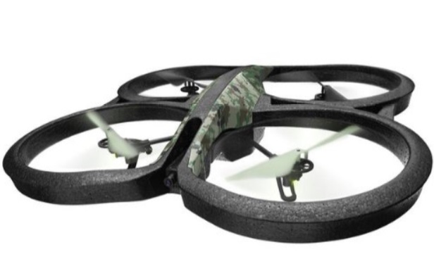
5. Doosan showcases drone fuel cell powerpack in Las Vegas
The company said it is easy to refill fuel of its newly developed powerpack by simply replacing a detachable hydrogen container in the powerpack with a new one. A single charge of the hydrogen container also keeps drones flying for two hours, which is significantly longer than 20 to 30 minutes powered by existing drone batteries. 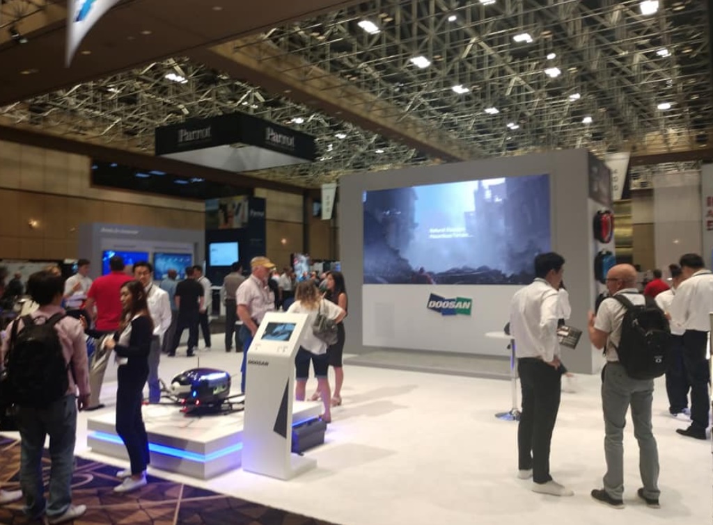
6. Where does the future lie for drones?
 ALT 105.7, Sully, radio, tech segment